-40%
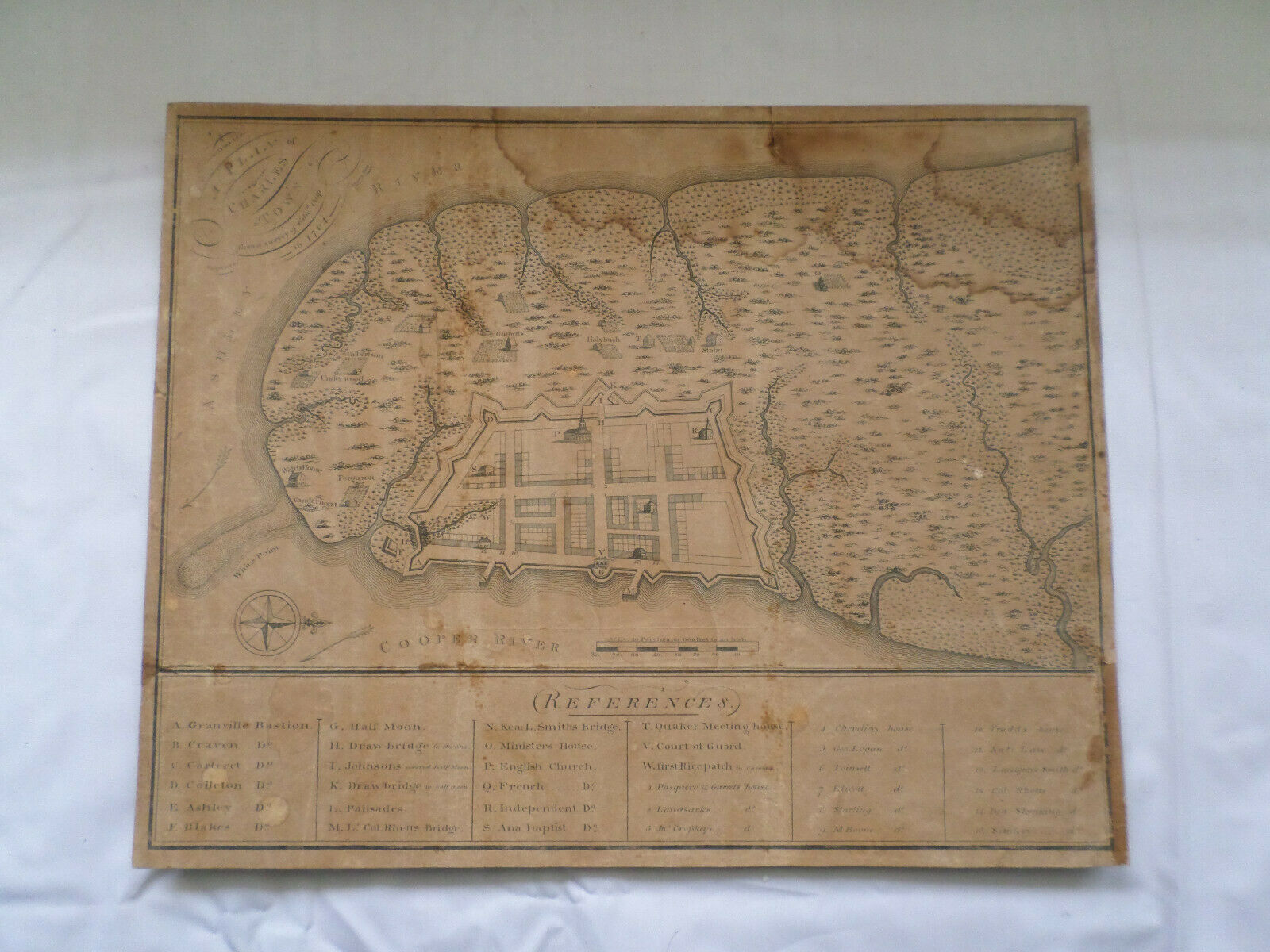
Rare Antique Map of "A Plan of Charlestown " from a survey of Edwd Crisp in 1704
$ 9240
- Description
- Size Guide
Description
HistoricalExtremely Rare Map
Edward Crisp
1704 Survey
"A Plan of Charleston"
(approx. 11.75" x 9.5")
This is a Scarce plan of Charleston from David Ramsay's
History of South Carolina created from the original Survey of Edward Crisp
and Printed by James Akin. The Key Below
includes
references to
36 places on the Map. Several outlying Farms are shown beyond
the town Grid and Fortifications, Including Vanderhorst,
Ferguson, Underwood, Gilbertson, Garnetts, and Stobo
The Homes of 15 early settlers are also located.
The Original Crisp plan is essentially Unobtainable
as there
are only 4 that exists
making
this the only Collectable Example
of the Map
and Extremely Rare to find this Map for Sale
as there are Few Known Examples
The map has been backed on thin paper board
has aging as should be expected for a map this old
and some edge missing at the lower right side
that is shown in my Pictures and overall in
Nice Antique Condition
For the
Advanced
Collector
of
Colonial American
Maps
Please look at my Pictures as they are an Important part of my Description
as they Show Exactly what you will Receive and Please ask
Questions before you Buy as I am Always
Happy to Answer all Inquiries
Please Note: Payment is due at Purchase and This is Pickup Only or you can arrange Shipping & Insurance yourself and I will take to the Carrier you choose


