-40%
1881 Oconto Marinette (Florence Forest) County Wisconsin Maps Rare Transitional
$ 44.88
- Description
- Size Guide
Description
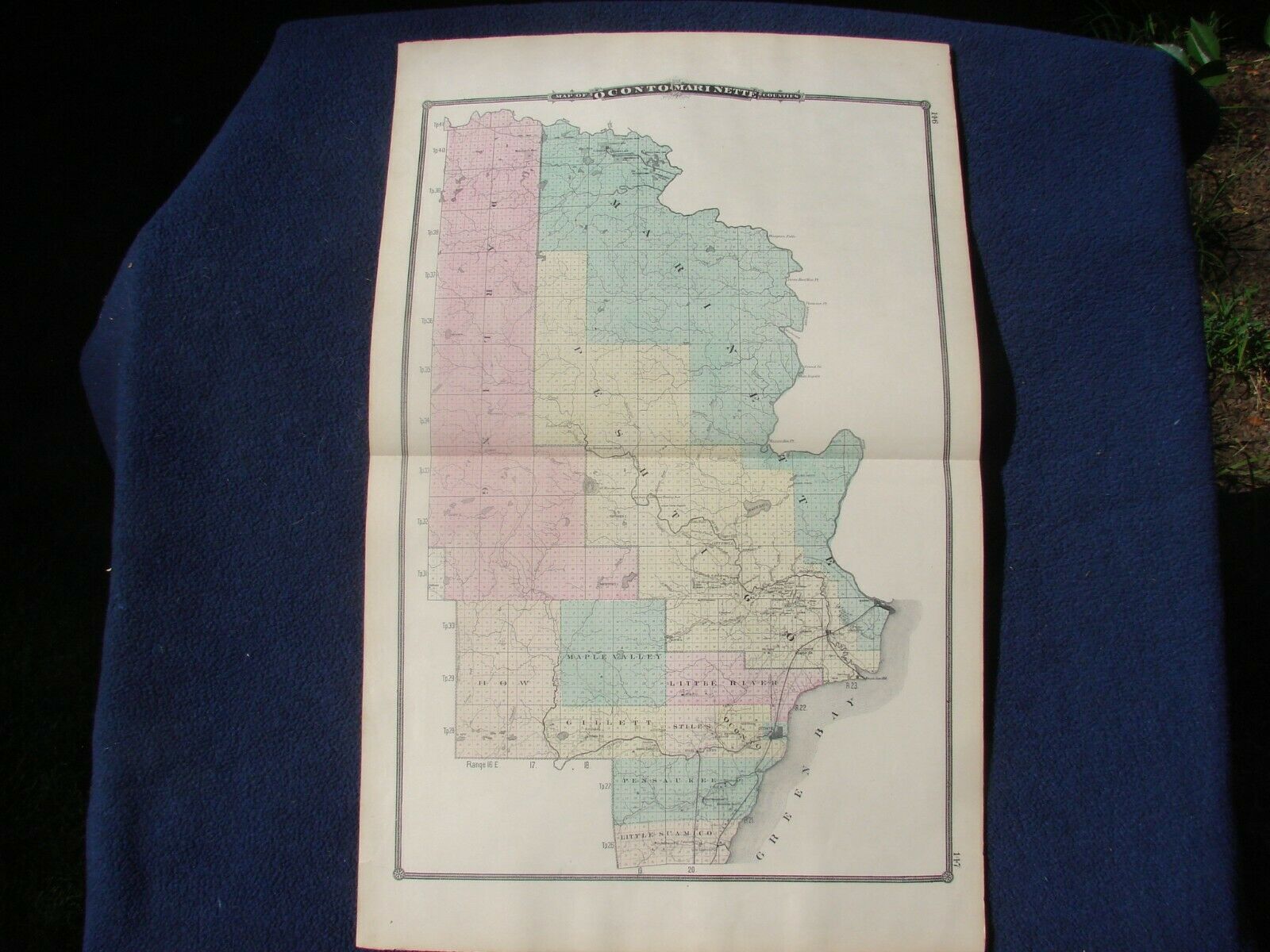
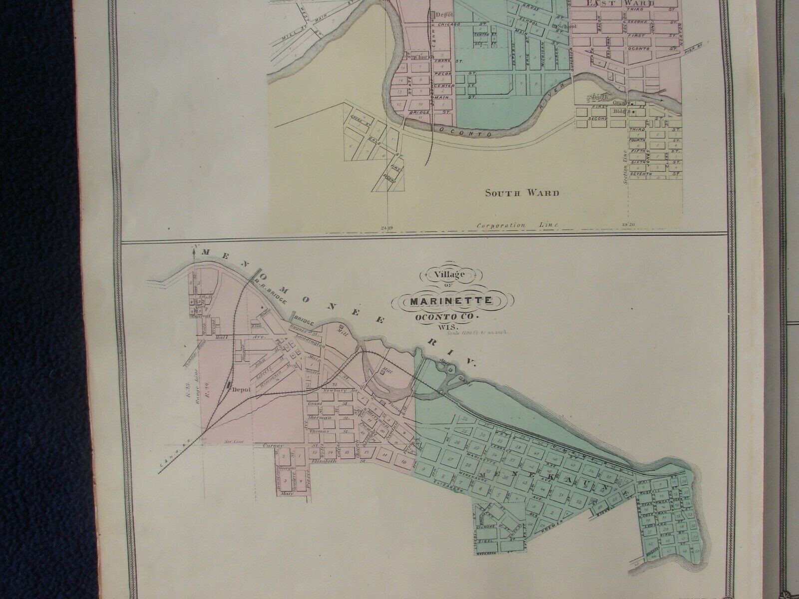
Map of Oconto and Marinette Counties (with) Map of the City of Oconto and Village of Marinette (with) Maps of Ahnapee (Kewaunee County), Peshtigo (Marinette County), Florence, and Sturgeon Bay (Door County) WisconsinPublished by H. R. Page & Co., Chicago, 1881
Original double-page, double-sided, hand colored lithographic map sheet with centerfold, as made, consisting of a double page map of Oconto and Marinette Counties (which include parts of present-day Florence, Forest and Menominee Counties) on one side and single page city plans and maps of Oconto and Marinette on one half side and the 4 remaining plans on second half, each extracted from H. R. Page’s “Illustrated Historical Atlas of Wisconsin”, the last of the 3 great Wisconsin State atlases published during the latter half of the nineteenth century and arguably the finest and most complete. Map sizes: Oconto/Marinette - 24 x 15 ¾ inches; both town plan sheets – 15 ¾ x 13 ¾ inches, on sheet with broad margins.
These simple yet attractive and long-obsolete maps focus on political and cultural aspects of the covered areas plus additional features, many of which are listed below, and would tastefully adorn any home, cabin or vacation rental. If you have an interest in any of these Wisconsin places, old maps offer a unique window into the past that can inspire conversation, reflection, and appreciation.
What could possibly have changed over the past 140 years?
Condition: Generally very good and clean with light age toning and a few small toning spots in blank areas except for the Peshtigo plan, which has an area of toning spots that affect the printed image and margin. Please view the photographs for more detail about condition and content and, of course, feel free to ask questions.
Content: The county maps are colored by civil townships and show
survey township, range and sections; cities and towns; wagon roads; railroads and stations; post offices; churches and schools;
rivers and lakes; mines; and more. Even a number of private residences are named (presumably prominent citizens or subscribers to the atlas). In the earlier Snyder/Van Vechten atlas, the map of Oconto County, then at its full extent, was published on 2 sheets. After removing the area of the recently created Langlade County (formed 1879), Page & Co. combined these 2 sheets into one large double-page map showing the new county of Marinette (formed from Oconto in 1879) using a double dashed line but no county names other than those contained within the title. Both counties were later reduced in area with the formation of Florence County in 1881, with Oconto County being further reduced with the formation of Forest County in 1885 and Menominee in 1959. This map, therefore, is one of the earliest maps, if not the earliest, published at a county scale to show Marinette County, and certainly one of only a very small number, if not the only one, to show these counties in this unique 2-year transitional state (a WorldCat search for Oconto and Marinette maps published during 1879 to 1881 returned no other maps of these counties during this period). Of further note, Oconto/Marinette county is one of only a handful of double page maps published in the atlas.
Each of the 6 city maps are colored by ward, subdivision or addition and contain information such as extent; named streets; city blocks; and railroads.
The Sturgeon Bay map shows buildings such as churches, hotels, mills, docks, and a few other places of public interest (why this map appears here instead of an inset on the Door County map eludes reason). Marinette village, the current county seat of Marinette, is identified in the plan with Oconto county, being an uncorrected remnant from the Snyder/Van Vechten atlas. The Ahnapee, Florence and Peshtigo plans do not appear to have been published in the earlier Wisconsin atlases thus making these small plans a unique addition to the Page atlas.
A scarce assemblage of maps each containing historical information of a bygone age when the pace of life was regulated by the speed of a horse, steam locomotive or steamboat (and paper map!) for these then relatively young Wisconsin counties and towns. By 1881, Wisconsin had begun to recover from the crippling economic Panic of 1873 – the worst US depression until 1929 – making the publication of a third state atlas economically viable even following tepid public reception to the previous Walling/Tackabury and Snyder/Van Vechten Wisconsin atlases. Each atlas was an improvement over its predecessor with changes made to formatting and content, although many of the Page and Snyder/Van Vechten maps share a very similar appearance and are cartographically almost identical, having been produced from the same plates. Close examination of Page and Snyder/Van Vechten map pairings sometimes reveal minor additions and removals by Page; however, major changes occurring within the few year span between these publications, such as county boundary redefinition due to new county formation, city/town map additions or removals, and new illustrations, were also made.
H. R. Page & Co. also published atlases of a small number of north mid-western US and southern Canadian counties, maps of selected US states, and other subjects up until the late 1880’s. Their Wisconsin State atlas endures as their most ambitious, comprehensive and best-known work. Wisconsinites are fortunate to have such a rich resource of affordable and display worthy cartographic material at their disposal.


